Shire of Cunderdin At A Glance
Shire Population: 1,390 (2011).
Our Lifestyle
 Life in the Wheatbelt Shire of Cunderdin provides residents with the ‘best of both worlds’ - a vibrant country community that offers all the benefits of small town living, and easy access to the city. Situated only 158 kms east of Perth, it’s a comfortable two-hour drive to the capital or just 90 minutes to Midland. Low crime rates and strong community commitment make living in the area a safe, happy and positive experience.
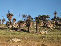
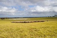
Encompassing the towns of Cunderdin and Meckering, the Shire covers an area of 1872km2 and is mainly agricultural but offers the opportunity for other industries and businesses thanks to its proximity to Perth and the quality and size of the Cunderdin Airstrip.
With numerous fantastic community-run events, living in the Shire gives people the opportunity to really be involved and connected. It’s certainly a far cry from not knowing your neighbour in the block of city apartments.
Our Facilities
With a range of sporting facilities including a 50-metre swimming pool, a hospital, doctor, schools, an award winning Agricultural College, excellent services and businesses and a multitude of proactive community organisations, the Shire is a progressive alternative to the hustle and bustle of city life. That’s not to say life’s not busy here but it’s a different, more community based involvement that gives people a chance to spend time with their family, friends and other residents to work together to make where they live a better place.
Weather
 Weather-wise the conditions in the Shire are moderate and pleasant with an average maximum temperature of 25.10C and an average minimum temperature of 11.4°C. The temperature remains in the mid 30’s or above between December and February. The average annual rainfall is 366.8 millimeters with the wettest months usually being May to September.
The Towns situated along the famous Golden Pipeline Cunderdin and Meckering both have strong connections with water. Meckering is a name originating from a local Aboriginal language meaning ‘place of water’ or ‘moon on the water’ depending upon interpretation. It was largely thanks to the reliable Meckering Well that gold seekers originally stopped in the area. Cunderdin’s growth was largely due to water becoming available to the area through the Goldfields Water Supply (known today as the Golden Pipeline) – an amazing engineering feat still marveled at today. The agricultural regions that opened up over a century ago are still thriving and both communities enjoy the benefits of a vibrant country lifestyle. Residents have access to a variety of services, facilities and organizations and there is plenty for visitors to experience in both towns.
Cunderdin
Population: 850 (town)
Location: 158kms east of Perth
 Cunderdin is a typical Wheatbelt country town – with many of its population relying on the agricultural lands surrounding it. There is a strong community spirit and residents often rely on each other to ensure the ongoing success of the area.
If you’re visiting Cunderdin you shouldn’t leave without stepping inside the Cunderdin Museum – it literally has to be seen to be believed and even if you’re not a regular on the museum trail you won’t regret your decision to step inside this one. It’s hard to fathom that it’s been established and constantly improved through largely voluntary labour. Today the result is arguably one of the best rural Museums in the state if not the country. With the ongoing support of the National Trust and a recent State Government grant the Museum has undergone an upgrade with a new and very impressive interpretive center housed in the old pump house.
Like Meckering, Cunderdin is situated on the Great Eastern Highway and many tourists and passers can’t help pulling over to take pictures of Cunderdin’s Ettamogah Hotel. Made famous by the popular Ken Maynard cartoons the strikingly different looking pub is quite a draw card - not only for ‘out of towners’ but for locals as well.
Meckering
Population: 150 (town).
Location: 132km east of Perth.
Probably most famous thanks to the 1968 earthquake - one of the worst in Australia’s history - Meckering today is still a vibrant and successful country community. Although relatively small in terms of population the town manages to largely ignore this and achieve more than many areas twice its size. With a strong commitment to history combined with an energetic enthusiasm to move into the future, Meckering is a town that offers its’ residents plenty of opportunities both socially, within the community, and from a work perspective.
Please visit the ‘Visitors’ section of this website to find out more about what to see and do in our Shire.
Cunderin Shire Statistics 2010-2011 (As Included In The WALGA Directory)
Cunderin Shire Statistics 2015-2016 (As Included In The WALGA Directory) Information
| Council Statistics |
|---|
| Distance from Perth (km) |
158 |
|---|
| Area (sq km) |
1,872 |
|---|
| Length of Sealed Roads (km) |
376 |
|---|
| Length of Unsealed Roads (km) |
466 |
|---|
| Population |
1,390 |
|---|
| Number of Electors |
848 |
|---|
| Number of Dwellings |
575 |
|---|
| Total Rates Levied |
$1,779,965 |
|---|
| Total Revenue |
$5,198,854 |
|---|
| Number of Employees |
28 |
|---|